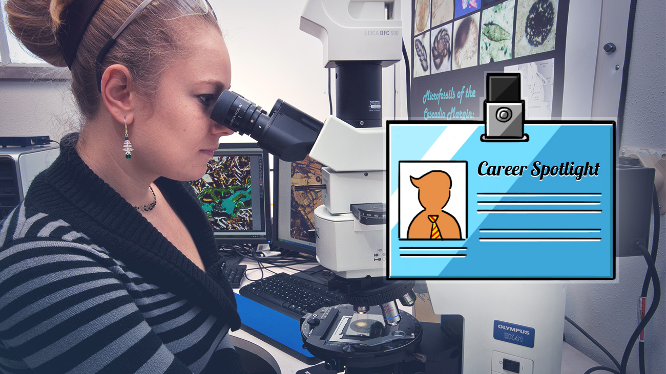
An article originally by Andy Orin found on Lifehacker here: http://lifehacker.com/career-spotlight-what-i-do-as-a-research-geologist-1690402642
It’s appealing to think that a geologist spends most of their time scouring remote landscapes with a rock hammer and a magnifying glass, but in reality they spend more time in a laboratory than a Land Rover. The work of a research geologist is eclectic, analytical, and scientific.
To learn a little about the field, we spoke with Circe Verba, Ph.D., a young researcher at the National Energy Technology Laboratory, and who has previously worked with NASA and SETI. Circe is also involved with science outreach and education with high school students, and has even designed a LEGO set depicting what it’s like to be a geologist. Now let’s take a look through the microscope:
Tell us a little about yourself and your experience.
I am a research geologist at the National Energy Technology Laboratory’s (NETL) Office of Research & Development (ORD). I specialize in bridging geochemistry and civil engineering—specifically projects that involve carbon sequestration and wellbore integrity (relevant to mitigating climate change) and understanding the interaction of oil-gas shale in unconventional systems. My expertise is electron microscopy and image analysis.
What drove you to choose your career path?
I had many inspirations as a child; it started with my earth science class with discovering the planets. I had a thirst for knowledge to understand processes at a macroscopic scale down to a micro-scale. Geology is a multidisciplinary science that spans several fields, such as engineering and research, which enabled me to pursue several interests.
How did you go about getting your job? What kind of education and experience did you need?
I wanted to pursue a career that would expand my perception of the universe by conducting research. I participated in high school science clubs which provided a scholarship opportunity to attend college at Oregon State University. Research (nowadays) requires a Ph.D., which took me long nine years. During my undergraduate, I explored astronomy, oceanography, and geology. I studied microbial boreholes in freshwater pillow basalt for planetary applications. Then I started a geology master’s program at Northern Arizona University, studying Martian aeolian [wind erosion] and volcanic features as part of a NASA HiRISE fellowship. Once that program ended, I switched gears and participated in an Oak Ridge Institute for Science and Education (ORISE) post-graduate fellowship in 2009. At NETL I was encouraged to further my education which led to the completion of my Ph.D in 2013, and a permanent job studying engineered systems on Earth.

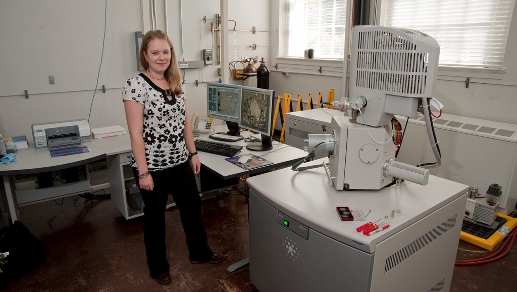
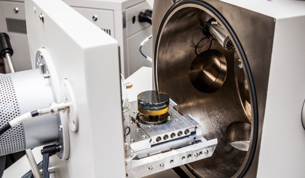
Verba in the lab with a SEM (Scanning Electron Microscope).
What kinds of things do you do beyond what most people see? What do you actually spend the majority of your time doing?
My time depends on what stage the project is at—at the moment I have four projects in different stages. I can spend time in the laboratory conducting experiments, analyzing and characterizing samples under an electron or light microscope, or working on the computer drafting manuscripts for publications. I also spend a lot of time interfacing with other team members and key partners from universities. It is also vital for scientists to communicate with one another on their work at scientific conferences.
What misconceptions do people often have about your job?
One misconception is not about my job, but more about the field. A common joke is that geology is rock for jocks, however, geology can be quite complex. In addition, as a geologist you get a lot of random rocks brought to you hoping for special identification when it’s usually a common rock like an agate (quartz-polymorph).
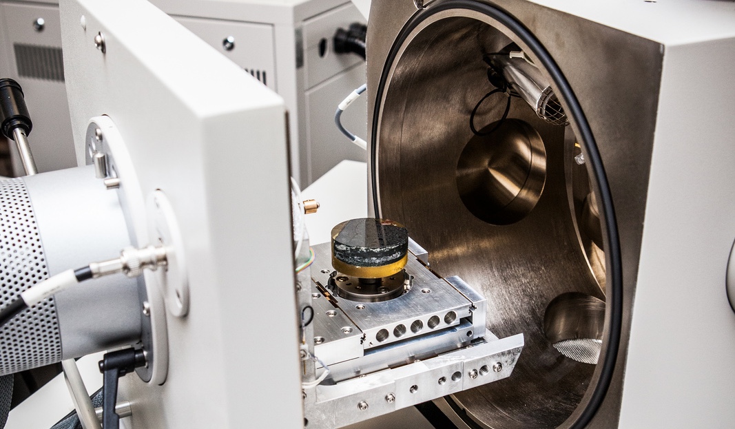
A close up view of a sample inside a SEM (Scanning Electron Microscope).
What are your average work hours?
A normal, professional work week—40 hours/week. More if there are deadlines or traveling.
What personal tips and shortcuts have made your job easier?
Spreadsheets are essential for project management to keep track of project tasks or budgets, as well as from a technical stand point to understand chemical analyses and to calculate, graph, and import data.
Another tip is sharing data; part of being a scientist is to not replicate work that has been done or is being conducted. It is then helpful to publish the research or put data onto a database for distribution. We use the Energy Data eXchange (EDX) at NETL.
What do you do differently from your coworkers or peers in the same profession? What do they do instead?
As I said above, I spend more time in the experimental and petrographic laboratory and interpreting the results. I spend less time in the field than my peers, for example, collecting samples, mapping regions, or being on an oil rig. In addition, several of my peers primary focus use applied geophysical modeling or geographic information system (GIS) to capture, store, manage, analyze spatial data. Furthermore, many geologists are in academia, which includes research and teaching.
What’s the worst part of the job and how do you deal with it?
Personally, the worst part of the job is the amount of technical writing required. You undergo a lot of revisions for technical reports and peer reviewed journal articles. I’m a descriptive writer, so I’ve had to learn to reign it in and learn from mistakes.
What’s the most enjoyable part of the job?
The most enjoyable part of the job is when I’m using the microscopes. You get to see details down to a micrometer scale, something the naked eye can’t see. It’s an unseen world that I get to be a part of. It can also be like a micro-treasure hunt to find changes in mineral phases or microorganisms.
What kind of money can one expect to make at your job?
Salary can range depending on your education level and where you are employed. The bottom 10% make $46k whereas the median salary for geologist in all sectors is $84k.
How do you move up in your field?
A geologist can advance their career by getting additional certifications (e.g. registered geologist) or pursue higher education. Specifically where I work, advancement of job positions [would be] into project management, such as technical team coordinator, team lead, or division director.
What advice would you give to those aspiring to join your profession?
The best advice I can give to an aspiring geologist is to never stop learning. Take as many science courses so can to figure out what field interests you, such as geology, engineering, physics, or mathematics. In addition, geography, computer science, environmental science, GIS, and drawing/art courses are also very helpful. Geology is a wide field with many hot topics to explore, including environmental or climate change, energy, geological hazards or mitigation, and mining. Examples of [jobs] in the field are engineering geologist, geochemist, geophysicist, hydrologist, mudlogger, wellsite geologist, environmental consultant, exploration geologist in academia, the oil, gas, petroleum sector, engineering or construction firms, government, museums, and private industry.
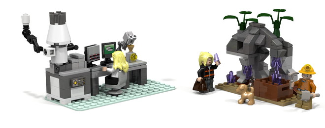
I created the Research Geology LEGO set [because] I am also an active participant in Science, Technology, Engineering, and Mathematic (STEM) education by being involved in high school career fairs and science activities. I feel that it is important to find fun ways to encourage children, of both genders, to use critical thinking skills. As an adult, I still play with LEGO, a cobblestone of my childhood. So I created a LEGO set called Research Geology, which highlights my career as a research geologist both in the field and in the laboratory. While I included both genders in my set, I wanted to highlight that women can be scientists too. I strongly believe that we can impact young minds and pave the way for future scientists. We can change the world, one geek at a time.


 Show-Me Rockhounds member Dan Snow has provided these geologic maps of Kansas City from 1917 which contain topographical, geological, and cross-sectional data. The maps show where to find several different types of rocks common to this area. They are also a great way to see how Jackson County has changed in the last 100 years. The maps are in PDF format and are very high resolution, so please zoom in!